Salar del Diablo Project

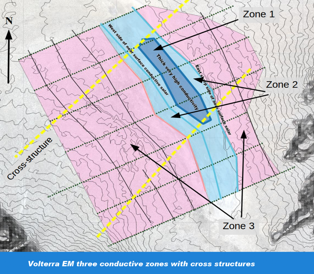
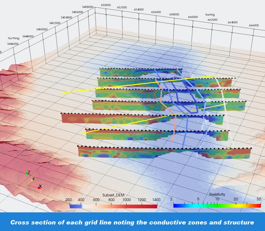
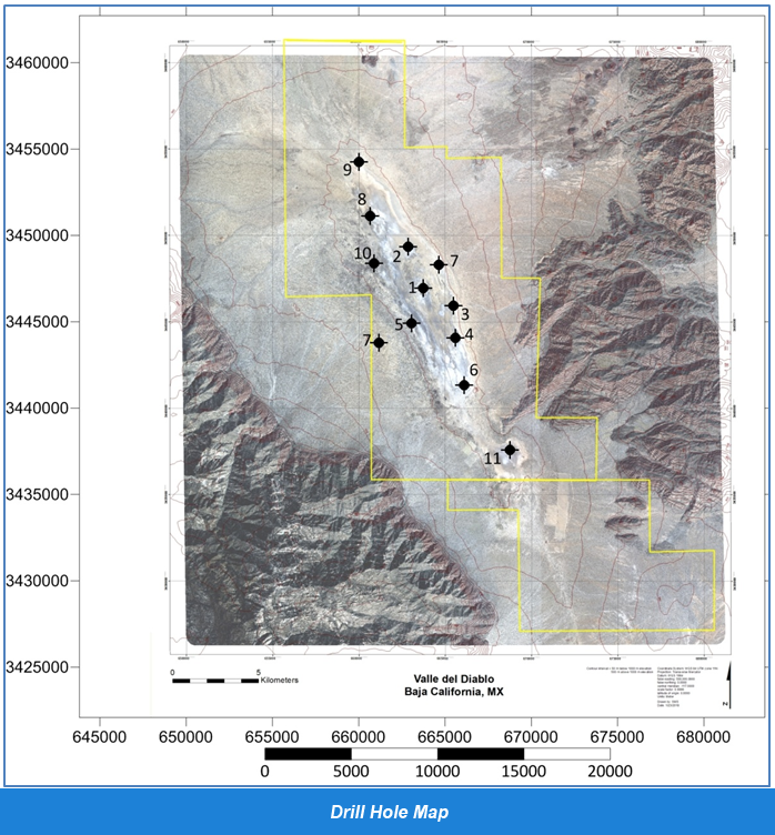
Pre-drilling exploration covered 14% of the property that included 80 line kilometers of a time domain electromagnetic survey, geochemical sampling, geological mapping, and satellite imagery structural analysis. A 12-hole drill program started on May 24, 2019 to intersect geophysical, geochemical, and geological targets. The drilling program was suspended on June 13, 2019 as the initial five holes did not drill deep enough to intersect any targets.
Montgomery & Associates (M&A) became the new Operator in August, 2019.
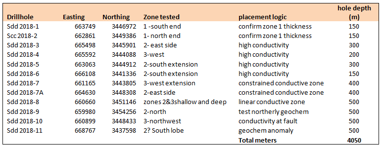
In October, 2019, drilling resumed with a four-hole program to reach depths of 600 meters per hole. DDH-1 was drilled adjacent to the previous hole # 1 that reached a depth of 650 meters and the second hole, DDH-2, was drilled 12 kilometers to the south and adjacent to the old hole # 11 that reached a depth of 594 meters. DDH-3’s location is 50 kilometers to the south of DDH-2 where drilling is planned to start during october,2020. Depending on results from DDH-3, DDH-4 maybe drilled in the same area.
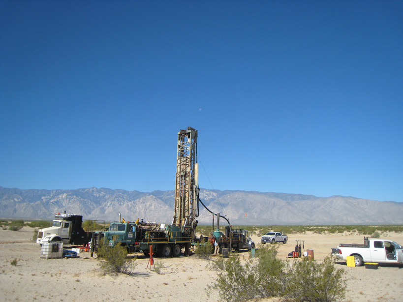
Drilling hole 2019-9, May 24 2019
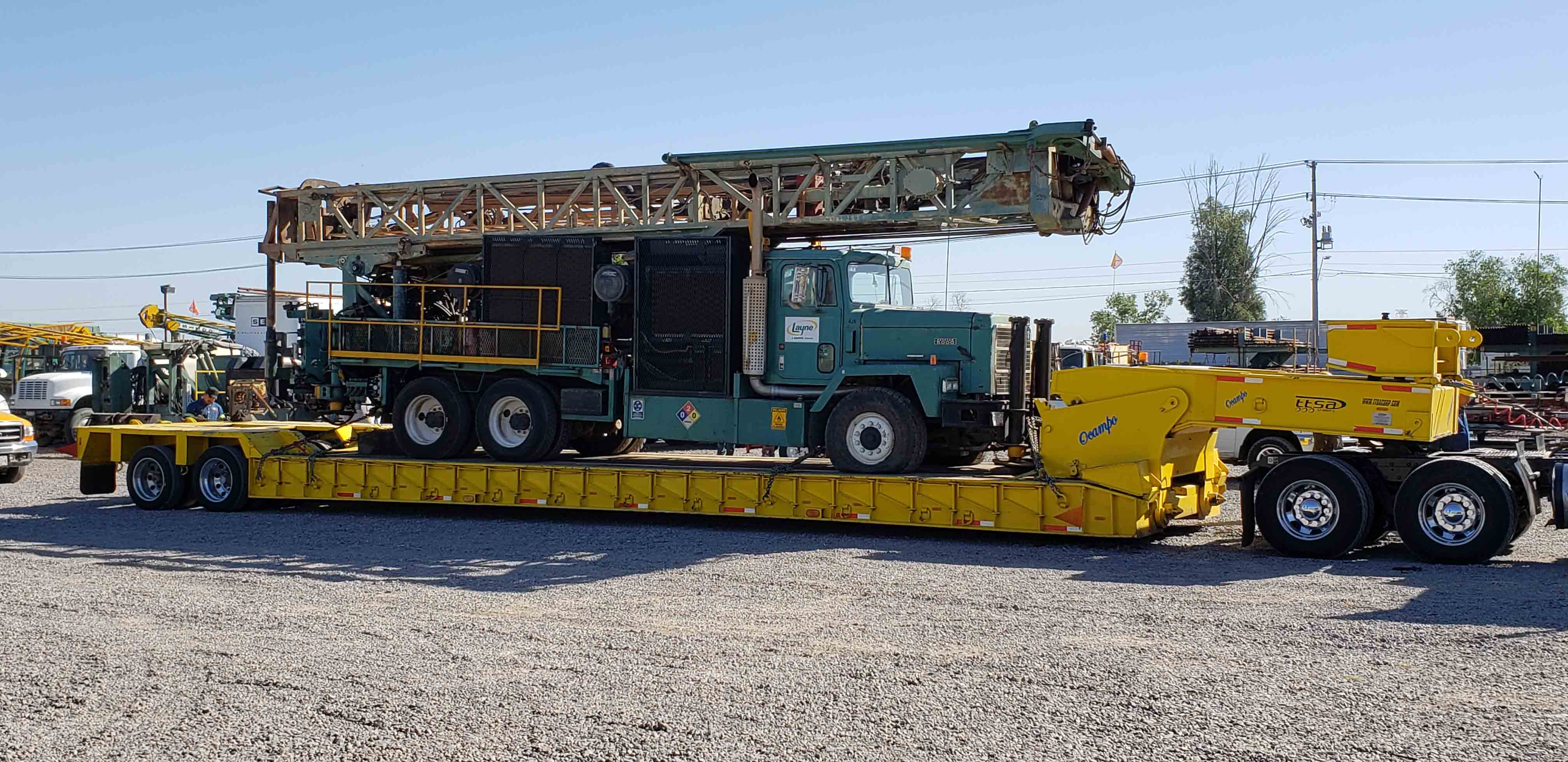
TH 100 reverse circulation drill on site which is capable of drilling to 600 meters (1,900 feet)
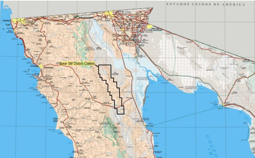
Salar del Diablo Lithium Property
The Salar del Diablo is a 103,430-hectare (400 square mile) property that covers a large salar. The Property is located in the State of Baja California, Mexico.
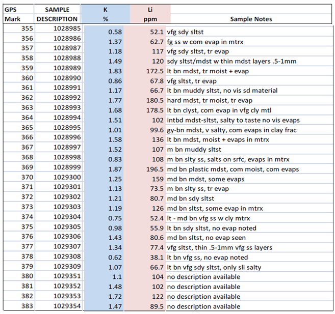
Approximately 14% of the property has been explored by geochemical sampling, a geophysical survey, geological mapping, and satellite imagery structural analysis. A time domain electromagnetic survey consisted of 80-line kilometers composed of 7 lines spaced two kilometers apart that covers 150 square kilometers.